Duration: (43) ?Subscribe5835 2025-02-08T04:55:06+00:00
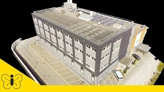
senseFly HQ in 3D – Mapped by a senseFly albris Drone
(43)
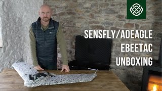
Sensefly/AgEagle eBeeTAC Full Review: Enhanced Tactical Mapping Drone | Brigantes.com
(1:59)
senseFly HQ in 3D – Mapped by an albris drone
How PPC Uses senseFly's Professional Drones To Survey Coal Mines More Efficiently
(4:44)
Best senseFly drones for agriculture – Meet the Experts: Martin Scheiber
(2:7)
Using senseFly Fixed-Wing Drones to Offer Cost-Effective Aerial Mapping Services
(2:)
You will be Shocked by this FPV Drone⚡️🏋🏻♂️ Sub250g Oasisfly30 Review
(12:56)
Dron senseFly eBee X | GEOCOM
(3:27)
Introducing senseFly eBee AG
(7:50)
The BEST so far! NO JELLO! Flywoo FlyLens 85 Review
(19:36)
eBee X Fixed-Wing Drone - senseFly S.O.D.A. 3D
(4:20)
SUPER FUN!!! - SpeedyBee BEE25 4S Cinewhoop Review
(22:38)
Inspecting the Tseuzier Dam with an albris Drone
(5:32)
3D mapping of an open-pit Iron Ore mine by senseFly eBee X drone
(7:30)
senseFly presents: Mapping the Impossible
(4:)
AgEagle Ebee Tac - Overview
(7:20)
Improving the Interpretation of Satellite Data with Low-Altitude senseFly RTK Drone Data
(2:14)
senseFly - All Drones, All The Time
(1:17)
senseFly eBee X with MicaSense RedEdge-MX - Agriculture Drone With Multispectral Camera
(1:40)
Corridor Mapping In Turkey With An eBee Drone
(4:24)
Revealing the senseFly eBee Geo Surveying Drone
(58)
RMUS TechConnect™️ | senseFly eBee X Landing Examples
(1:21)
senseFly Teaser - \
(39)
Sensefly ebee Plus Overview
(40:15)
Using Drones to Optimise Cement Plant Efficiency
(4:30)
eBee SQ - The Advanced Agricultural Drone
(3:12)
senseFly Corridor - Linear Drone Mapping, Made Simple
(1:49)
senseFly S.O.D.A. - Sensor Optimised for Drone Applications
(1:5)
senseFly LIVE Announcement - Feb. 15, 2021
(20)
Inspiring Communities and Governments to Think Spatially With senseFly Professional Drones