Duration: (4:15) ?Subscribe5835 2025-02-23T23:08:32+00:00
Leica Map360 2021 - Walk Fly Cloud
(2:28)
Leica Map360 V4.0 - Intersections, Crosswalks and Parking Stalls
(1:50)
Leica Map360 2021 - Overview
(3:21)
Leica Map360 2022.1 - Overview
(1:15)
Fast, Effective Scene Diagramming with Map360 2022
HOTTEST DRONE LIDAR AVAILABLE
(18:35)
How to Combine BLK360 Laser Scans with REGISTER 360 BLK Edition
(45:2)
Complete Reality Capture Workflow with BLK360
(11:30)
Leica iCON build v8.5: What's new in the software release for building construction
(7:10)
Leica DISTO™ X6 - How to measure 3D from multiple locations? 3D measurements made easy (2024)
(3:15)
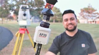
How Accurate is the Leica AP20 AutoPole with a Surveying Total Station?
(9:48)
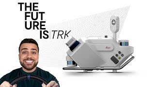
How LiDAR Mobile Mapping works - Leica TRK
(26:35)
Leica TruView Tutorial: GeoTag Features and Pipe Measurement Tools
(6:50)
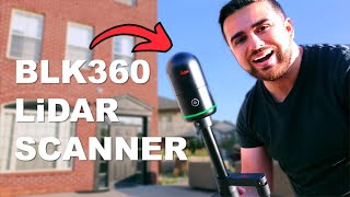
Leica BLK360 Laser Scanner Review \u0026 Accuracy Assessment
(12:36)
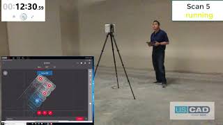
RTC360 Demonstration: Hospital Basement
(22:1econd)
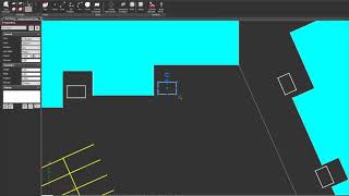
Leica Map360 V4.0 - Simple Drawing and Editing Tools
(2:54)
The Leading Forensic Crime Scene Mapping Software - Map360 2024 Overview | Leica Geosystems
(1:56)
Leica Map360 2021 - 3D Model Types
(4:15)
Leica Map360 2022.2 - Bullet Path Reconstruction Improvements
(2:21)
Leica Map360 2021 - 3D Position Control
(4:58)
Leica Map360 V4.0 - New Layer
(45)
Leica Map360 2021 - 3D Models
(1:49)
Leica Map360 2022.2 - Overview
(1:6)
Leica Map360 V4.0 - Scale Image
(1:1econd)
Leica Map360 V4.0 - Momentum
(1:42)