Duration: (1:16) ?Subscribe5835 2025-02-15T05:16:09+00:00
GeoPLUS - Koordinate
(1:18)
GEOPLUS - KOORDINATE - KODNA LISTA
(1:26)
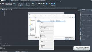
GeoPLUS - Koordinate - Import
(39)
GeoPLUS - Koordinate - KALKULATOR
(1:57)
GeoPLUS - Koordinate - Kartiranje
(1:53)
GEOPLUS u digitalnom elaboratu - KOORDINATE
(1:34)
GeoPLUS - Koordinate - Sakupljanje
(1:16)
Land Surveying Software - Longitude / Latitude
(14)
How to extract coordinates from Google Earth Pro
(4:40)
How-to TBC - Point Cloud Module Series - Chapter 2 - Georeferencing
(8:45)
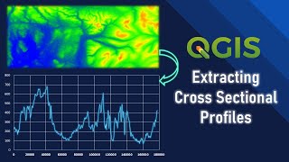
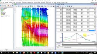
Extracting Cross Sectional Profiles using QGIS
(9:26)
GNSS TUTORIAL- POST-PROCESSING STATIC DATA USING COMPASS SOLUTION SOFTWARE BY COMNAV TECHNOLOGY
(20:49)
Magnetic Tutorial - Karoo - 1 Importing databases, creating grids and maps
(36:35)
How to convert GPS coordinates into GPX file and upload to AllTrails.
(6:)
Convert coordinates of a point
(6:23)
How to Process Geometrics Land Magnetometer Data
(29:41)
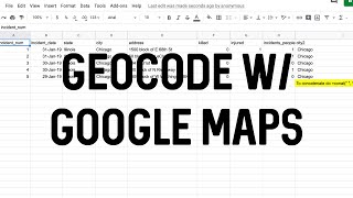
Geocode Data Using Google Maps
(8:14)
Extract Geolocation Coordinates,Geotag From Images,Photos and save it on One Table
(4:50)
GeoPLUS-GeoCALC - Import koordinata
(1:52)
GEOPLUS - SKI Import koordinata
(2:9)
Translation/Rotation tutorial
(3:8)
Datat Format - Cogo - Land Surveying Software
Introducing Geo-Plus
(2:52)
Comment géo-référencer un nuage de points avec Geo-Plus Vision Lidar ?
(7:32)
Geo-Plus
(2:43)
Civil Software - Edit
(18)
Land Surveying Software - Note Manager
Land Surveyor Software - VisionPlus - Fix
(8)