Duration: (1:43) ?Subscribe5835 2025-02-26T17:51:36+00:00
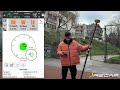
Multifrequency GNSS RTK eSurvey e100 KIT. SurPad 4.2 Land Surveying Software.
(1:16)
BASE AND ROVER GNSS SETUP USING KNOWN COORDINATES(FOIF A90, SURPAD SOFTWARE )
(8:48)
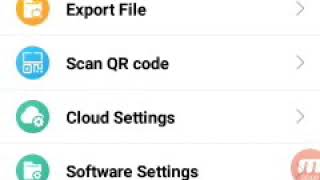
How to Import \u0026 Export Data using SurPad 4.2 Software
(8:51)
Step-by-step guide to using SurPad 4.2 and how to operate G990II and E800.
(9:45)
Webinar GNSS: X5 + SurPad App
(51:19)
SURVEY GPS CHINESE MODEL:FULL TRAINING IN ONE VIDEO CHINESE SURVEY GPS,NEW JOB,STAT RTK\u0026STICKOUT
(21:46)
Surpad 4.2 subdivision land lots
(36:6)
1
(19:46)
Tutorial de SurvX 4.0
(35:22)
Survey Easy for surveyors
(9:59)
How to Add Google Earth Image in Your AutoCAD Plan. With Original Coordinates.UTM
(15:41)
Calcula el área en tiempo real con el receptor GNSS Kolida K7 | Usando Survx o Surpad
(10:31)
How to stake out points using E SURVEY GNSS
(1:42)
SURPAD INICIO DE BASE Y ROVER CONFIGURACION DE RADIO EN CAMPO, REPLANTEO DE ZAPATA DE EDIFICACION
(27:27)
Interfaz, creación de proyectos y sistema de coordenadas - eSurvey SurPad
(5:8)
How to install SurPad 4.2 on Android 13 #surveying #surpad #topography
(40)
Surpad software ,how to activate it on P9IV collector
(43)
SurPad 4.2 | Πώς βελτιώνω την ακρίβεια IMU (μέτρηση υπό κλίση) του δέκτη μου | Pole Calibration
(2:38)
FoiF A90 A60pro rtk gnss surpad new version settings external radio mode
(1:56)
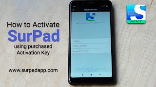
How to Activate SurPad 4.2 using purchased Activation Key
(44)
How to add kml or kmz files into SurPad 4.2 database #surpad #surveyingsoftware
(26)
Creating project \u0026 Setting Coordinate System using Surpad
(1:4)
SurPad 4.2 Activation. Step by step instructions.
How to install SurPad software and connect GNSS receiver
New Cloud Share Function of Surpad 4.2: Tutorial
(3:12)