Duration: (48) ?Subscribe5835 2025-02-07T09:27:29+00:00
PIX4Dsurvey - Feature Wrap-up Summer 2021
(7:11)
Pix4D - PIX4Dsurvey feature: Orthographic View
(35)
Pix4D - PIX4Dsurvey feature: Properties
(41)
Pix4D - PIX4Dsurvey feature: Join Lines
(50)
Pix4D - PIX4Dsurvey feature: Color by Elevation
(42)
Pix4D - PIX4Dsurvey feature: Split View
How to use DJI Mavic 3 Multispectral | PIX4Dfields in-field Tutorials
(18:39)
Pix4Dmapper masterclass with James Pick
(55:37)
Pix4D Mapper Complete Tutorial: Drone Image Processing with Ground Control Points.
(16:25)
iPhone LiDAR with RTK: Unveiling Pix4Dcatch AR and Emlid Reach RX Integration
(15:51)
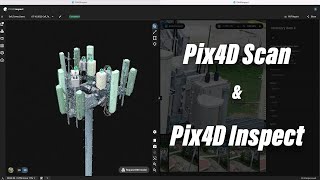
Creating Digital Twins with Pix4D Scan and Pix4D Inspect
(17:5)
CREATE Orthophoto Mosaic and DSM with Pix4D Mapper
(10:19)
3D Modeling with Drones using PIX4Dmatic
(17:26)
Processing Drone Images with GCPs using Pix4D Mapper
(50:28)
Exporting and sharing layers | PIX4Dfields Beginner Tutorials
(9:45)
Pix4D Mining Webinar - Featuring Pix4Dmatic \u0026 Pix4Dsurvey
(32:58)
Pix4D - PIX4Dsurvey feature - Low-Pass Grid
(1:)
Pix4Dsurvey version 1.0
(24:16)
Pix4D - PIX4Dsurvey feature: Color Selection
(59)
Pix4D - PIX4Dsurvey tutorial: 1. Create and open a PIX4Dsurvey project
(2:11)
Pix4D - PIX4Dsurvey feature: Project Settings Part 2
Pix4D - PIX4Dsurvey feature: Share to PIX4Dcloud
(49)
Pix4D - PIX4Dsurvey feature: Pix4D - Volume Measurement
(39)
Pix4D - PIX4Dsurvey tutorial: 7. Create volume measurements in PIX4Dsurvey
(4:)
Pix4D - PIX4Dsurvey feature: 2D \u0026 3D Editing
Pix4D - PIX4Dsurvey tutorial: 4. Vectorize and create breaklines in PIX4Dsurvey
(4:20)